IMO Approves New Shipping Corridors in Bering Sea to Improve Safety

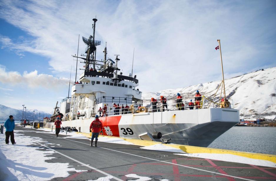
Coast Guard Cutter Alex Haley returns to homeport in Kodiak, Alaska in the Bering Sea. (Source: Courtesy U.S. Coast Guard/ Petty Officer 2nd Class Diana Honings)
The International Maritime Organization, part of the United Nations, approved a joint proposal by the United States and Russia to establish two-way shipping lanes across the Bering Sea and into the Arctic Ocean.
The International Maritime Organization (IMO), part of the United Nations, approved a joint proposal by the United States and Russia to establish two-way shipping lanes across the Bering Sea and into the Arctic Ocean late last week.
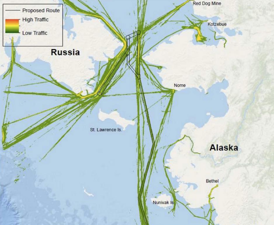
The newly adopted measure, bound to come into effect on Dec 1, specifies six two-way routes and six areas of precaution and aims to improve safety of navigation and reduce the risk of incidents and collisions.
While the use of these shipping lanes is voluntary, the measure is seen as the first step to a more comprehensive traffic-management route-system, which are common in densely traveled areas, such as the North Sea, the English channel, or the Baltics.
"As climate change makes Arctic waters accessible for new industrial activity, increased shipping traffic in the Bering region creates an urgent need for regulations to stay one step ahead of this growth," confirms Elena Agarkova, senior program officer for shipping in the US Arctic Program at the World Wide Fund for Nature (WWF).
"Today’s measures are a first step toward protecting these biologically diverse and culturally important waters."
Lanes charted to modern standards
Modern navigational charts
The shipping lanes are designed to help vessels steer clear of various shoals, reefs, and islands.
Shallow waters with depths as little as 18 feet of water, especially in the eastern Bering Sea, also represent a danger to maritime traffic as large vessels, which have larger drafts, venture into the Arctic.
While many parts of the Arctic Ocean have only been mapped to a resolution of one mile and thus lack accurate and detailed navigational charts, the suggested routes have been surveyed with modern technology.
The newly established routes ensure a water depth of at least 60 feet, sufficient for all but the very largest vessels in operation today.
"Large vessels will now have lanes charted to modern standards and areas to be avoided that can keep them from navigating too close to ecologically sensitive underwater habitat," states Eleanor Huffines, senior officer with Pew Charitable Trusts’ U.S. Arctic program.
Also read (the text continues)
It took the U.S. Coast Guard nearly a decade to identify challenges due to increasing traffic and to designate safe corridors. The joint proposal was derived from the Coast Guard port access route study and was submitted in November 2017.
Making the Bering Sea safer
Traffic through the Bering Sea has seen a rapid increase in traffic over the past decade necessitating the newly-established shipping lanes. Transit traffic more than tripled between 2008 and 2016 from 220 vessels to more than 600 ships.
With the opening of Yamal LNG and the future Arctic LNG 2 facility the Bering Strait will see more than 1000 transits within the next five years, the U.S. Coast Guard expects.
In addition to large vessels carrying hydrocarbon resources out of the Arctic, the Bering Sea is also host to a large number of smaller non-fishing and fishing vessels.
Together these vessels accounted for more than 110,000 individual voyages in the waters between Russia and Alaska in 2014 and 2015.
"We have observed a steady increase in Arctic shipping activities over the last decade, and these routing measures were jointly developed in response to this increased activity," say Mike Sollosi, the chief of the U.S. Coast Guard Navigation Standards Division.
In addition to the routes and areas of precaution the IMO also designated three areas to be avoided based on recommendations by the U.S. Coast Guard around the areas of Nunivak, King and St. Lawrence islands.

Traffic patterns in 2014 and 2015 and proposed two-way routes (Source: International Maritime Organization)
Just the first step
The voluntary shipping corridors can be but the first step to enhancing safety of navigation in the Bering Sea and a full-fledged Traffic Separation Scheme (TSS) or a geographically more focused Vessel Traffic Service are the next logical steps.
"WWF urges continued collaboration in this area to ensure that additional spatial designations and other regulatory measures are put in place to reduce the risks for the region," confirms Dr. Simon Walmsley, WWF’s senior advisor for Arctic sustainable development.
Under a TSS, implemented by the IMO and used to regulate shipping in busy and narrow waterways, vessels are required to sail in the same direction within the TSS and steer clear of specified areas with opposing traffic.

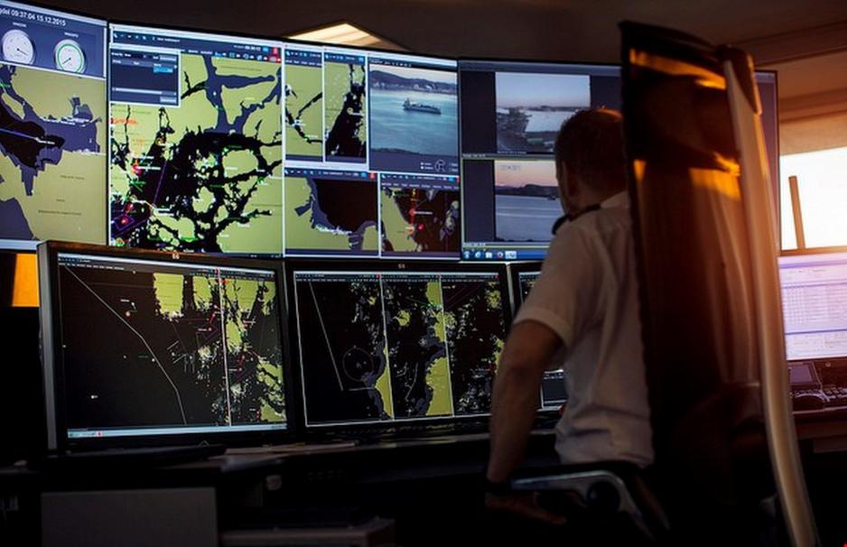
Kvitsøy Maritime Traffic Center in Norway (Source: Courtesy of The Norwegian Coastal Administration)
Vessel Traffic Service (VTS) functions similar to air traffic controls in the sky routing vessels along a designated path to avoid other vessels or obstacles.
Such a system would not be feasible for the Bering Sea as a whole, but could be implemented along its most narrow 82 kilometers-wide section.
Such a system has been successfully operated along the Norwegian coast line since 1978. Today Norway operates five VTS centers, with the newest one in Vardø opening in 2007.
That facility monitors the majority of all tankers and other hazardous traffic along the country’s entire coastline and around the archipelago of Svalbard.


