US and Russia Propose Two-Way Shipping Routes in Bering Sea

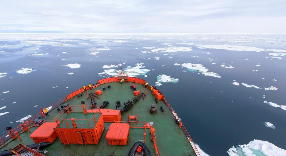
Icebreaker navigating in Arctic waters (Source: Christopher Michel on Flickr)
The United States and Russia jointly propose a routing system for vessels passing through the Bering Strait and Bering Sea.
The United States and Russia jointly propose a routing system for vessels passing through the Bering Strait and Bering Sea. The scheme aims to organize and direct ships along fixed corridors passing through these Arctic waters and thus reduce the risk of collisions.
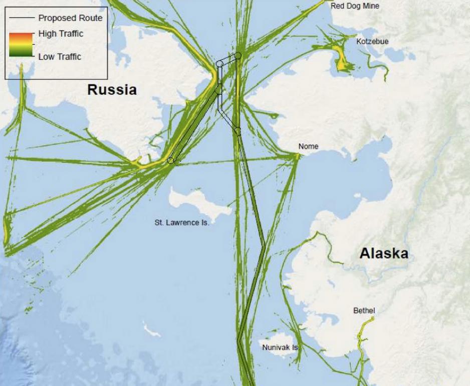
The proposal comes in the form of a document jointly submitted to the International Maritime Organization suggesting the establishment of six recommendatory two-way routes and six precautionary areas in the Bering Sea and Bering Strait.
The routes would be of a voluntary nature aimed at vessels weighing in excess of 400 tons.
Less ice means more shipping
Rapid reduction in ice coverage and growing economic activity are the primary drivers for increased shipping traffic in the region.
"Over the past decade, the U.S. and Russia have both observed a steady increase in Arctic shipping activity," said Mike Sollosi, the chief of the U.S. Coast Guard (USCG) Navigation Standards Division
During the calendar years 2014 and 2015 the Bering Strait and Bering Sea saw 51,142 transit segments by non-fishing vessels larger than 400 tons, according to the submitted document. In addition 60,925 transit segments by fishing vessels were recorded.
The most common type of non-fishing vessels were bulk carriers (20,120) and container ships (15,228).

Traffic patterns in 2014 and 2015 and proposed two-way routes (Source: International Maritime Organization)
Transit traffic through the Bering Strait itself, the 82 kilometers-wide channel between Alaska and the Chukchi Peninsula in Russia, has also seen significant growth. Between 2008 and 2015 traffic grew nearly 250 percent from 220 transits to 540.
Further growth is expected, especially with ongoing natural resource exploration in Russia’s Arctic, including the Yamal LNG project.
Cooperation in challenging waters
The routing system also aims to help ships avoid numerous shoals, reefs, and islands.
The eastern Bering Sea in particular is especially challenging to mariners, the report explains, due to relatively shallow waters with average depth ranging from just 6 meters to 75 meters offering "minimal under keel clearances."
Many of the bathymetric and hydrographic charts mariners rely on today were produced over 100 years ago. Most areas have only been mapped with a resolution in excess of one mile and are thus not suitable for safe navigation.

Andrew Holland, Director of Studies and Senior Fellow for Energy and Climate American Security Project. (Source: American Security Project)
The cooperation is also a sign that "the US and Russia continue to work together on small areas of common interest in the Arctic," explains Andrew Holland, Director of Studies and Senior Fellow for Energy and Climate American Security Project.
However, while the Arctic is an area of potential cooperation between the US and Russia, Holland cautions that one "should not expect this to grow into anything more than just what it is."
US Coast Guard lacks assets and presence
Despite these efforts to address the impacts of the rapidly increasing amount of traffic in the waters off Alaska, a host of challenges remains. The suggested two-way route is not currently marked by any existing Aids to Navigation, nor are there any aids proposed in the document.
Furthermore, unlike for example along the Norwegian coastline, no Vessel Trafficking System (VTS) to actively monitor and manage traffic in the region is in existence or currently proposed.
In contrast to its Russian counterparts the US Coast Guard operates very limited assets in the region. The US Coast Guard’s need for new equipment in the Arctic is well known – most pressing is an icebreaker, says Holland.
Need of infrastructure
In the case of the Bering Strait region in particular, "what’s most needed is an increased presence. The Coast Guard’s main Alaska base is in Kodiak – a long way from the [Bering] Strait. What’s needed is infrastructure enhancements along the strait – for instance, a medium draft port near Nome – that could allow a longer presence in the region," explains Holland.
"The US Coast Guard should also look to technology to help increase their awareness of the region – like autonomous drones or other aids that could increase situational awareness. All of this requires attention and investment by the US Government – something that they haven’t been willing to give in the Arctic for too long."
Thus, without much-needed material investments aimed at improving navigational safety in an area of increasing traffic the proposed shipping corridors can be but a first step in addressing the growing challenges in the Bering Sea region.


