Arctic Sea Ice Dodges Bullet – Still Ties 2007 for 2nd Lowest Extent

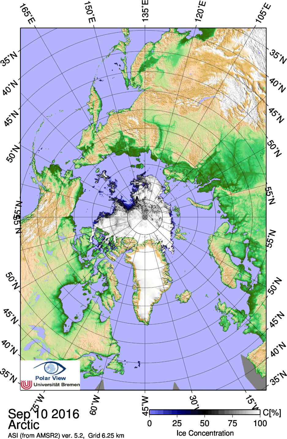
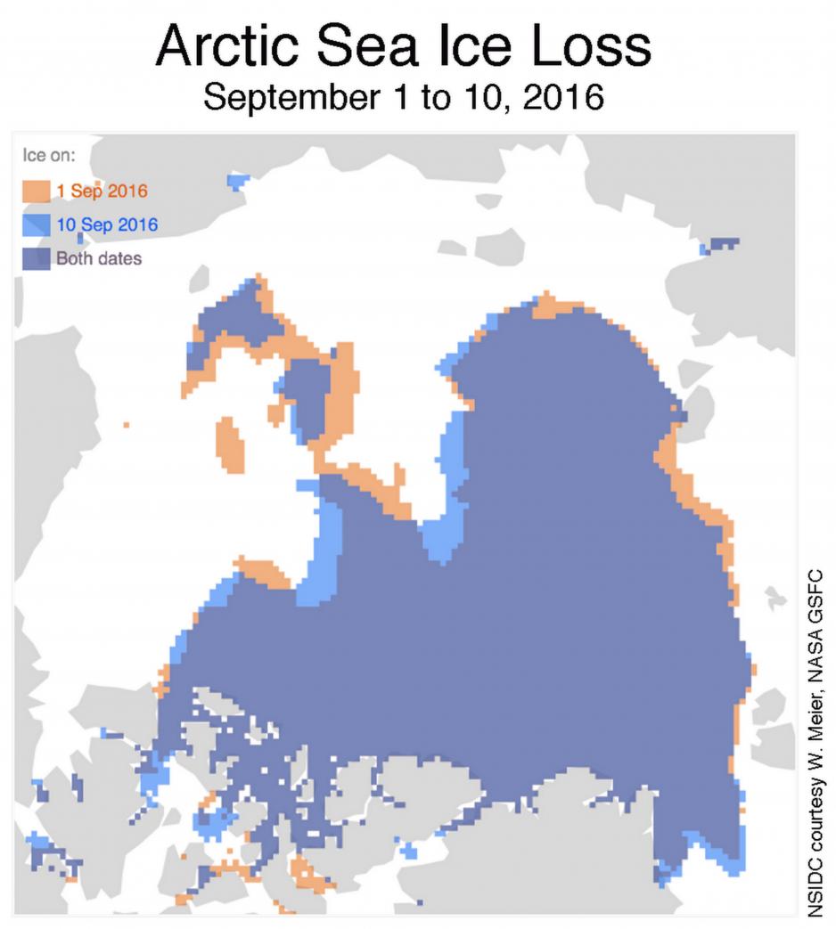
As the summer is coming to a close, Arctic sea ice extent reached its annual minimum on September 10th, according to the National Snow and Ice Data Center in Boulder, Colorado. And while many unknowns loom over the future of the Arctic, the setting or matching of record low ice extents continues to occur with unfortunate regularity and this year is no exception. With 4.14 million km2 ice extent 2016 is in a virtual tie with 2007 for the second-lowest extent on record, only behind 2012.

A New Normal
While the dramatic decline in 2007 led to a plethora of media and public attention being directed at the Arctic, this year’s extent has barely raised eyebrows thus far – a symbol of how quickly the public has accepted as new normal the dramatic changes occurring in the Arctic. This year’s near-record follows on the heels of a decade of shrinking ice coverage – the ten lowest ice extents since satellite observations began in 1979 have all occurred in the past 10 years. Table: Arctic Sea Ice Extent Minima, 2007-2016Year | Ice Extent in Million km2 | Date of Minimum |
2007 | 4.15 | Sept. 18 |
2008 | 4.59 | Sept. 20 |
2009 | 5.12 | Sept. 13 |
2010 | 4.62 | Sept. 21 |
2011 | 4.34 | Sept. 11 |
2012 | 3.39 | Sept. 17 |
2013 | 5.06 | Sept. 13 |
2014 | 5.03 | Sept. 17 |
2015 | 4.43 | Sept. 9 |
2016 | 4.14 | Sept. 10 |
1981-2010 Average | 6.22 | Sept. 15 |
Source: NSIDC
Rapid Melt Despite Favorable Conditions
The Arctic Ocean entered this year’s melt season in March with the lowest maximum ice extent on record, fueling concerns that 2016 may see a new record low after the dramatic declines of 2007 and 2012. It appears Arctic sea ice dodged a bullet in 2016 as generally favorable conditions for ice to “survive” – cloudy and cool – prevailed for much of the spring and summer.
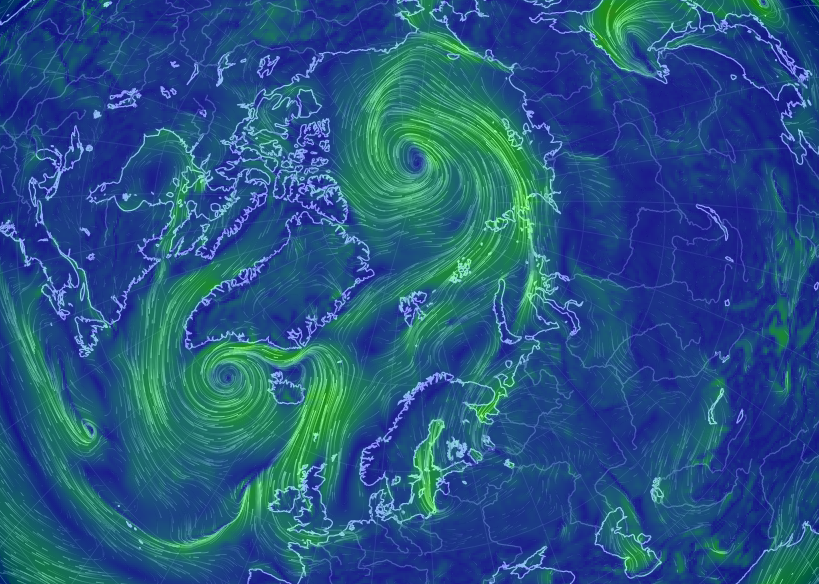
However, the fact that despite favorable conditions ice extent matched the record low of 2007 – a year with persistent high atmospheric pressure and strong winds promoting strong melting – indicates the weak state sea ice has entered. According to Prof. Mark Serreze, Director of the NSIDC, sea ice is considerably thinner than it used to be rendering it more vulnerable even when weather conditions are less conducive to melting.
“If the weather pattern this summer had been similar to what we saw in 2007, I strongly suspect that we would have hit a new record low, surpassing 2012,” Serreze warns.
Storms Batter Weakened Ice


Doubts about Recovery for 2017
While the Arctic sea ice continues on a downward trend according to Serreze, record lows in one year don’t necessarily mean low extents the following year. Quite the contrast. Record or near-record low ice extent is usually followed by a higher extent the following year. Both 2008 and 2013, saw a slight rebound of sea ice. Low ice extent allows for a lot of heat to escape from the ocean as it is not covered by a protective “ice blanket”. Heat, stored in the ocean, escapes unhindered while the ocean surface refreezes during fall and winter allowing ice extent to grow, explains Serreze.
As Arctic sea ice has made it through another summer melt season, extent will increase over the next six months before recording its annual maximum sometime in March. However, it appears that “a lot of heat in the upper ocean” may have assisted in the melting this year and to what degree this will influence the refreezing of the Arctic Ocean this winter will be an issue the NSIDC will be studying in the coming months.
